

The people and places of Australia’s World War I effort were officially remembered with the unveiling of commemorative nameplates in eight Earlwood Streets on Remembrance Day, Monday 11 November 2002 at 11am.
The street-names commemorate French and Belgium battlefields where Australians fought, and also recognise Australian wartime political and military leaders. Earlwood has a close connection with World War I veterans, with a large part of it being acquired in 1920 by the War Service Homes Commission to provide houses for World War I veterans.
The Commission often named its streets after themes associated with Australia’s role in World War I and, in Earlwood named and developed the streets Flers, Fricourt, Gueudecourt and Hamel Avenues, Polygon Cres and Ryrie Road. Hamilton and Kitchener Avenues were also named with a World War I connection by the private developer, the Sydney Permanent Freehold Land and Building Co Ltd, in 1915.
Local historian Dr Lesley Muir spoke at the unveiling, explaining how and why the streets came to have these names, and the local links she has uncovered with Canterbury.
Polygon Crescent, Earlwood
Polygon Wood in Flanders, Belgium, was captured by Australian troops in September 1917 in the Third Battle of Ypres. Seventeen men from the Canterbury district died in this action. The War Service Homes Commission, established to provide houses for servicemen returned from World War I, acquired a large part of the Undercliffe Estate in the early 1920s. In Commission estates, the streets were often named after battle places in France, Gallipoli and Palestine, where Australian troops fought in World War I. Flers, Gueudecourt and Fricourt Avenues and Hamel and Polygon Crescents were named in 1925.
Ryrie Road, Earlwood
Brigadier General Granville Ryrie commanded the Australian 2nd Light Horse Brigade throughout World War I, serving at Gallipoli, in the Sinai and Palestine. He was a brave soldier, an excellent leader and popular with his men. He was knighted in 1919. In 1920, the War Service Homes Commission acquired unsold blocks in the Glenore Estate (Marana, Calbina and Baringa Roads and Narani Crescent), and another section of the estate which it subdivided, naming one street Ryrie Road and extending Calbina Road.
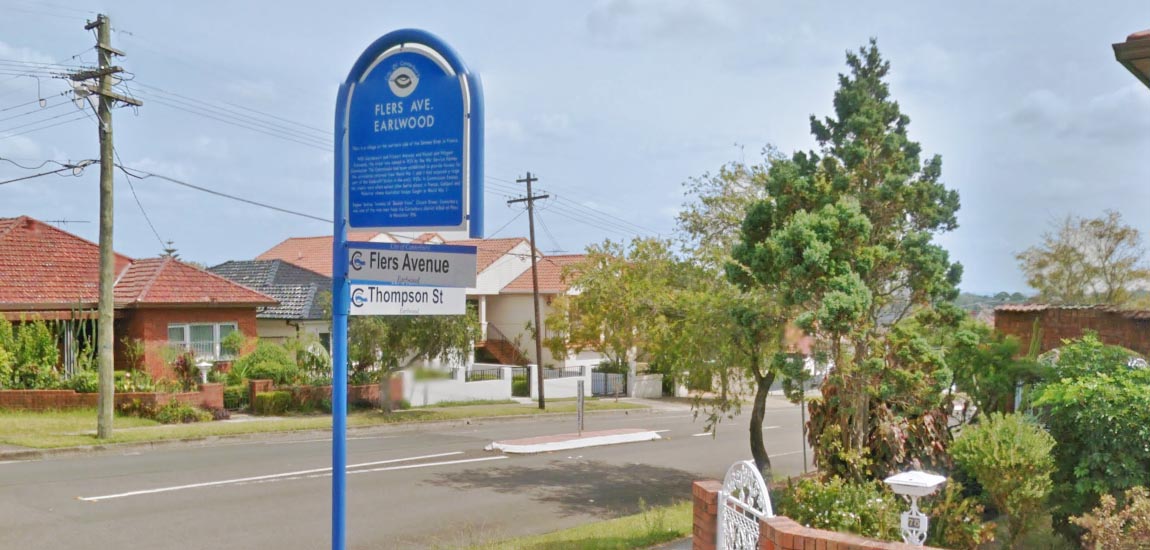
Flers Avenue, Earlwood
Flers is a village on the northern side of the Somme River in France. The street was named in 1925 by the War Service Homes Commission. Sapper Sydney Tomkins of “Beulah Vista”, Church Street, Canterbury, was one of the nine men from the Canterbury district killed at Flers in November 1916.
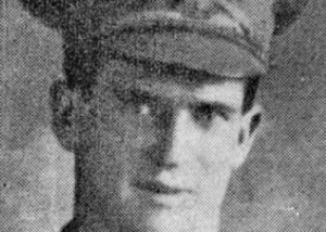
Studio portrait of 2834 Spr Sydney Charles Tomkins, 7th Field Company Australian Engineers, of Canterbury, NSW. A builder prior to enlisting, he embarked from Sydney aboard HMAT Suffolk (A23) on 22 December 1915. He was killed in action at Flers, France, on 14 November 1916, aged 26. He is buried in the Warlencourt British Cemetery, France. |
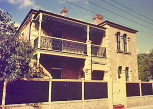
“Beulah Vista” at 15 Church St Canterbury. George Tomkins built Beulah Vista in 1888. City of Canterbury Council purchased the property in 1978 and completed extensive restoration work on the building in 1982. It is currently the headquarters of the Canterbury & District Historical Society. |
Hamilton Avenue & Kitchener Avenue, Earlwood
Hamilton Avenue and Kitchener Avenue were the names given to new streets in the Undercliffe Estate Second Subdivision, which was subdivided by the Sydney Permanent Freehold Land and Building Co Ltd in 1915. The Gallipoli campaign was underway and the streets were probably named to exploit the patriotic fervour of the time. Field Marshal Lord Kitchener was the British Secretary of State for War who ordered the attack on the Gallipoli Peninsula, and General Sir Ian Hamilton commanded the expeditionary force in the Gallipoli assault.